Nature Access and Health Equity
A nature prescription is only as fair as the places a person can reach. Telling someone to walk in a forest isn’t useful if the nearest high-quality trail requires a car. Recommending outdoor activity can be unsafe when the route lacks seating or accessible sidewalks. Advising a parent to take their child to a park ignores reality when the park is poorly maintained or does not feel welcoming.
Health advice cannot be separated from the environments in which people are expected to follow it.
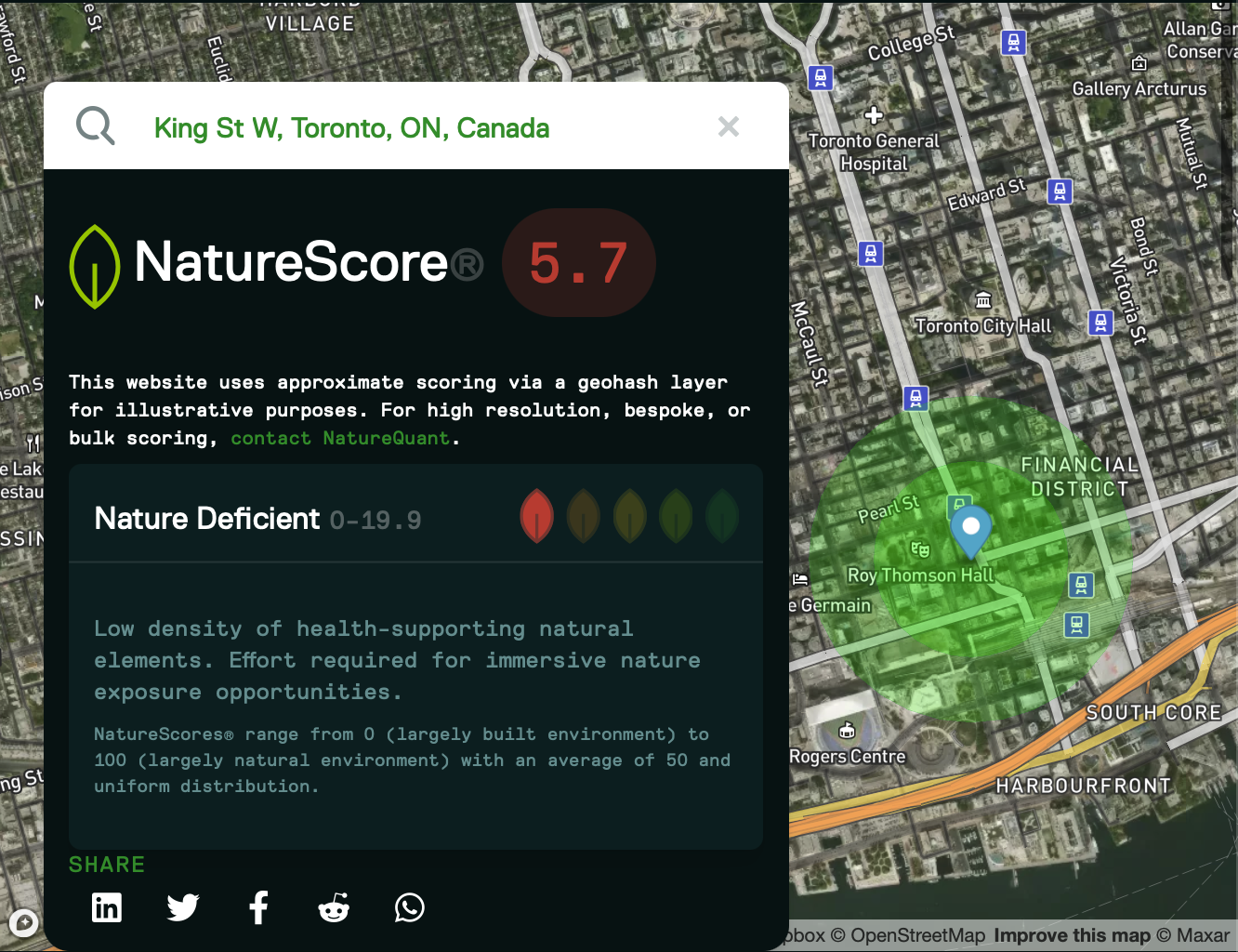
Nature-deficient urban core (NatureScore® 5.7)
This map illustrates a highly built-up section of downtown Toronto where roads, buildings, and other impervious surfaces dominate the landscape. With a NatureScore of just 5.7, the surrounding environment contains very few health-supporting natural features within walking distance. Residents and workers in this area have limited access to trees, greenspace, and immersive nature, highlighting how urban density without adequate natural infrastructure can contribute to a "nature deficit."
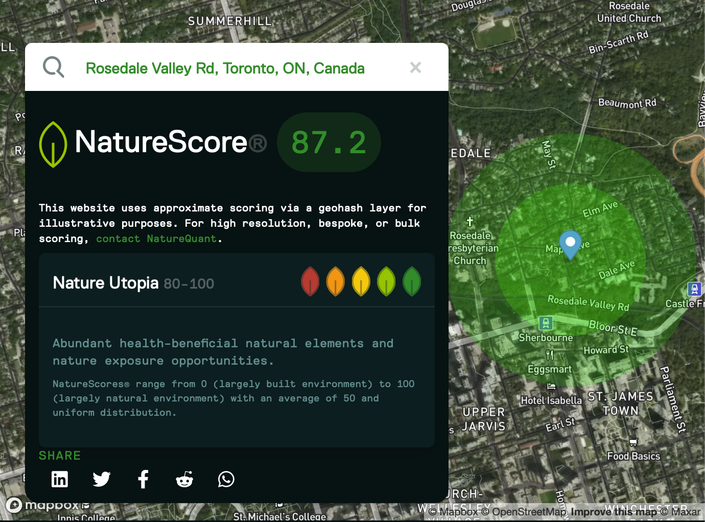
Nature-rich urban neighborhood (NatureScore® 87.2)
In contrast, this map highlights Toronto's Rosedale Valley, where extensive tree canopy, connected greenspace, and natural landscapes surround the neighborhood. The NatureScore of 87.2 reflects abundant opportunities for everyday contact with nature, supporting cooler temperatures, greater biodiversity, improved air quality, and easier access to restorative outdoor environments despite being located within Canada's largest city.
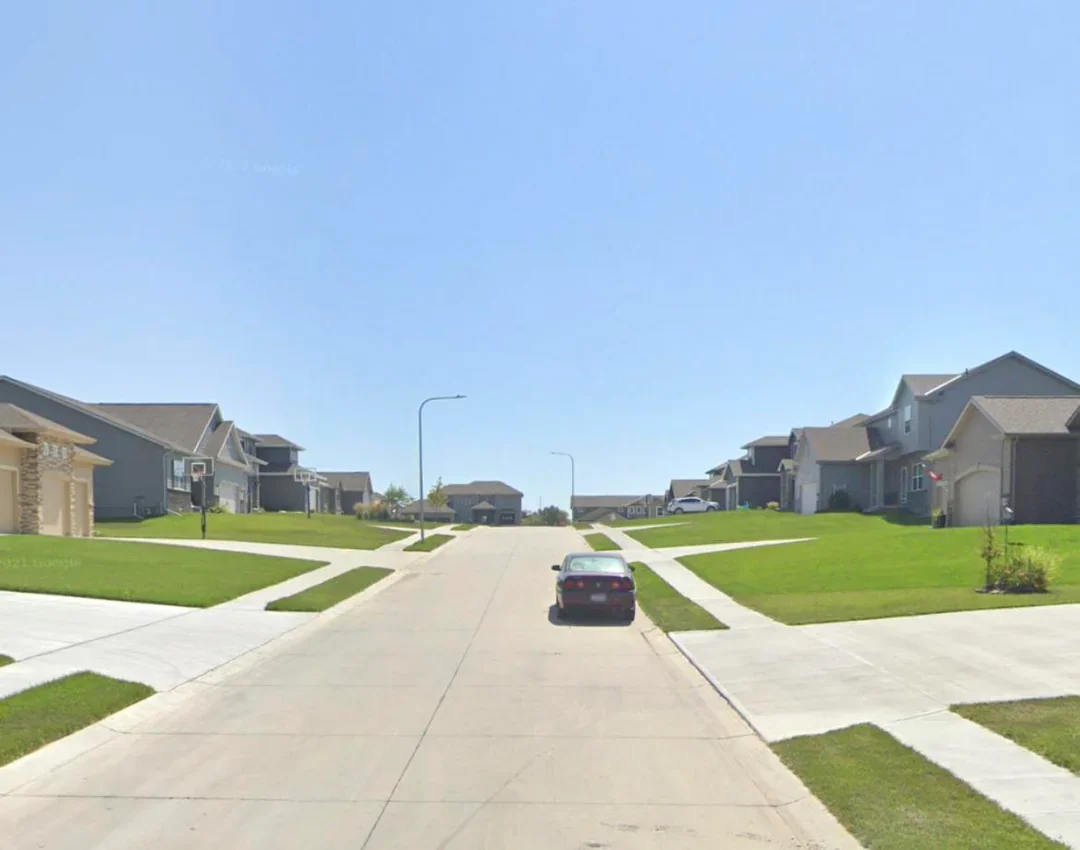
Despite its manicured lawns, this suburban streetscape contains no mature trees or visible street tree planting. The result is a biodiversity-poor environment with minimal shade, limited habitat, greater heat exposure, and few opportunities for meaningful everyday contact with nature. It highlights the difference between landscaping for appearance and designing neighbourhoods that function as healthy urban ecosystems.
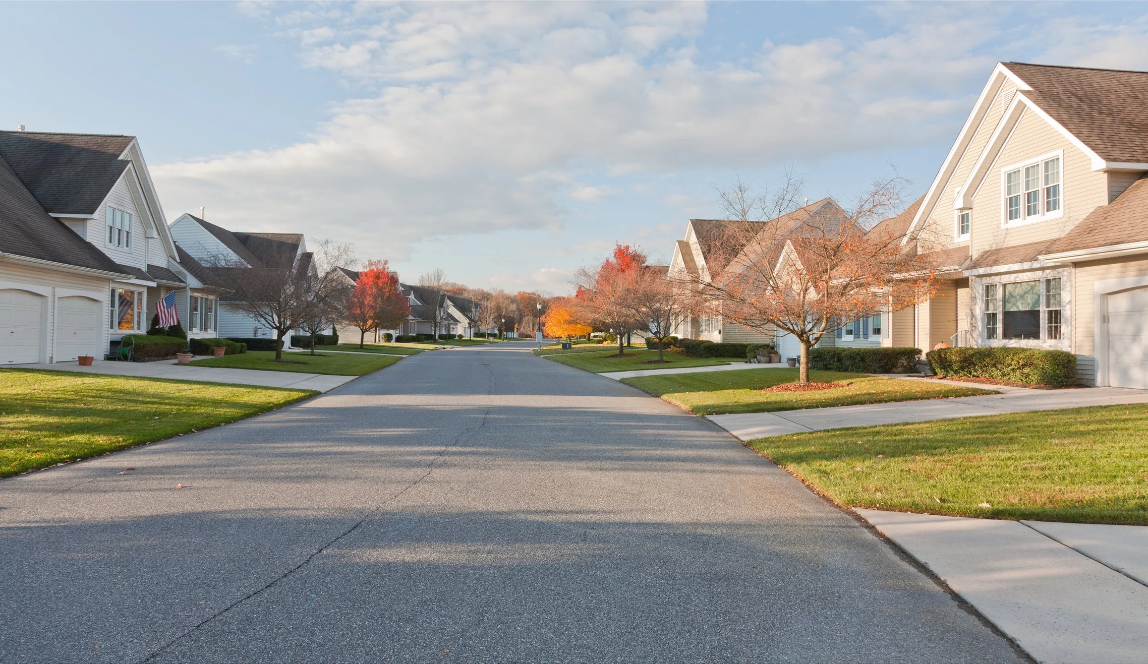
This suburban neighbourhood has begun investing in street trees, but the canopy is still in its early stages. Young deciduous trees line the street and will eventually provide greater shade and habitat, yet the streetscape remains largely dominated by expansive turf grass and exposed pavement. Compared with the first image, it offers greater biodiversity potential and seasonal interest, but it has not yet reached the ecological or human health benefits associated with a mature, interconnected urban forest.
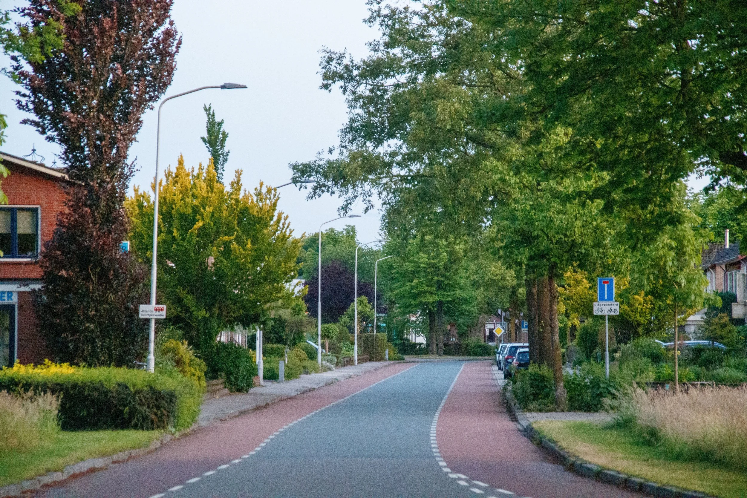
This streetscape demonstrates how urban design can intentionally integrate nature with active transportation. Mature trees, planted boulevards, gardens, and dedicated cycling infrastructure work together to create a cooler, greener, and more inviting public space. The dense canopy helps reduce summer temperatures, improves air quality, supports biodiversity, and encourages walking and cycling, illustrating how thoughtful urban greening can transform everyday streets into healthier places for both people and nature.
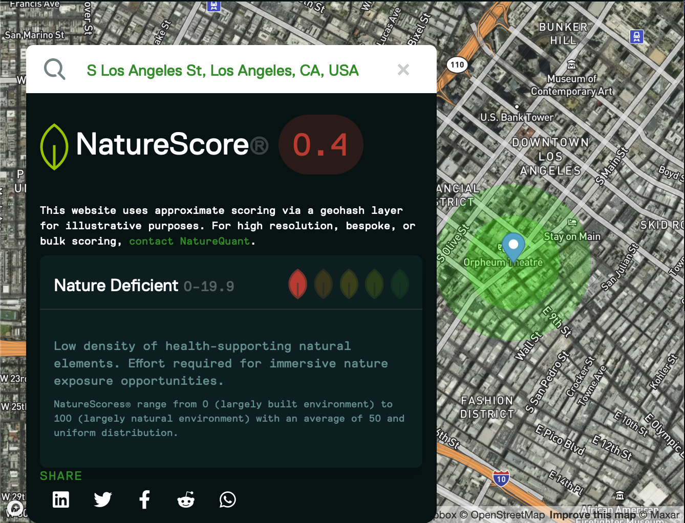
Downtown Los Angeles / Skid Row (NatureScore® 0.4)
This map depicts a location in downtown Los Angeles adjacent to Skid Row, one of the city's poorest and most underserved neighbourhoods. With a NatureScore of just 0.4, the surrounding landscape is overwhelmingly dominated by buildings, roads, and other impervious surfaces, offering almost no health-supporting natural environments within walking distance. The image illustrates how environmental deprivation often overlaps with socioeconomic disadvantage, leaving residents with limited access to the cooling, restorative, and health-promoting benefits of urban nature.
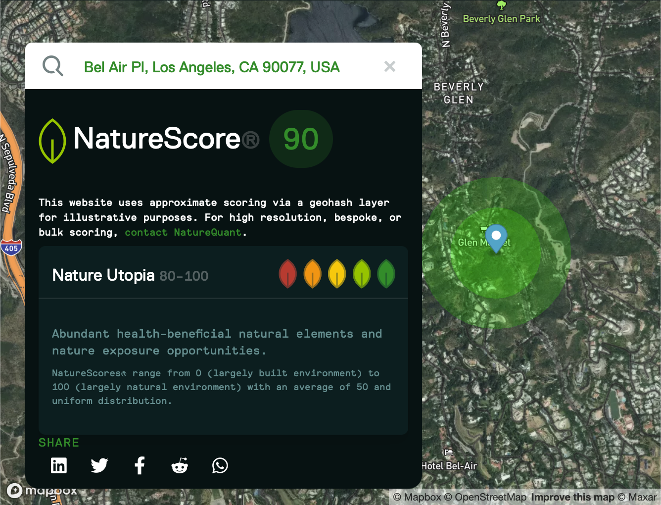
Bel Air (NatureScore® 90.0)
This map highlights Bel Air, one of the wealthiest neighborhoods in Los Angeles. Surrounded by mature tree canopy, extensive vegetation, and adjacent natural landscapes, the location achieves a NatureScore of 90.0, reflecting exceptional opportunities for daily nature exposure. The abundance of urban forest provides cooler temperatures, greater biodiversity, cleaner air, and restorative green space, demonstrating how access to nature is often concentrated in affluent communities.
Comparing and contrasting urban nature
These two maps above reveal one of the starkest examples of environmental inequity within a single metropolitan area. Although both locations are in Los Angeles, they differ dramatically in their access to health-supporting natural environments. The nearly 90-point difference reflects unequal access to many of the conditions that support health. These maps illustrate that access to nature is often distributed along socioeconomic lines, reinforcing the importance of investing in urban forests, parks, and green infrastructure as both environmental and public health interventions.
Is nature distributed equally in Canada?
No.
A Statistics Canada study examined residential greenness among approximately 5.3 million urban census respondents, representing nearly 22 million people after weighting. Lower residential greenness was observed among people with lower incomes, recent immigrants, tenants and many populations designated as visible minorities. Higher greenness was generally observed among higher-income residents, homeowners and non-immigrant White populations.
Unequal nature access becomes particularly dangerous during extreme heat. Neighbourhoods with fewer trees and more hard surfaces can become substantially hotter, while residents may have fewer resources for cooling, transportation or safer housing.
The relationship between nature, equity and climate resilience is therefore not theoretical. During a severe heat event, it can become a matter of life and death.